This is not a rulebook. It is what seven seasons, more than 1,100 cruising hours and over 1,000 locks have taught us aboard a 25-metre historic barge. Conditions and regulations change, so the final check must always be made with the relevant navigation authority.
Choose the destination, then test the route
The first thing I do is put our destination into PC-Navigo Yachting. Maria’s length, beam, draught and air draught are stored in the program, which checks the recorded locks, bridges, tunnels and other restrictions before we set off. About nine times out of ten the first route we try works for Maria. If it does not, we look again rather than trying to make the boat fit the plan.
Length and beam decide whether she fits the locks. Her deepest draught—about 1.25 metres at the skeg—matters when water is low or a channel has silted. Her air draught is about 3.39 metres in light condition, reducing to about 2.70 metres with the wheelhouse folded.
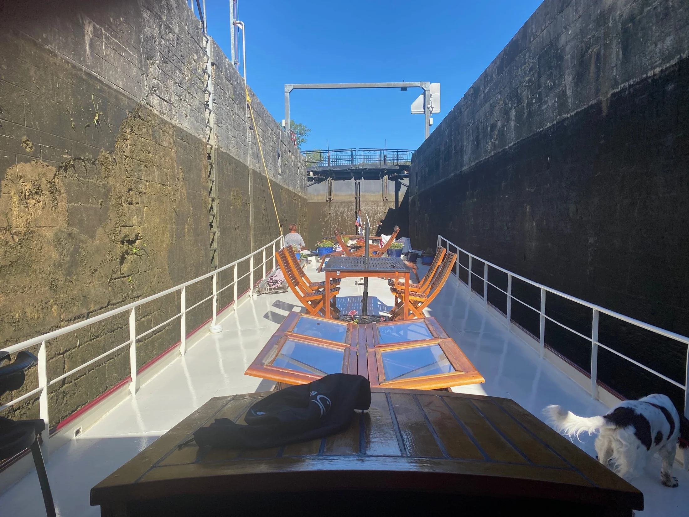
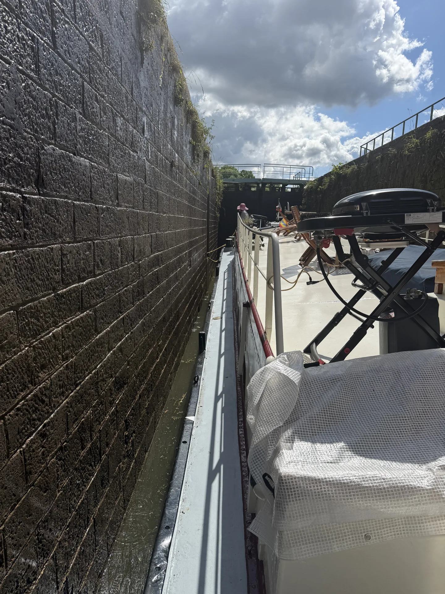
Much of France’s smaller canal network is built to the Freycinet gauge. A typical lock chamber is about 39 metres long and 5.20 metres wide, intended for boats up to roughly 38.50 by 5.05 metres. At 25 metres long and 4.76 metres wide, Maria fits within those dimensions, but the nominal beam clearance is still only about 22 centimetres on each side when she is centred.
The original Freycinet specification allowed 3.70 metres of clear height beneath bridges, giving a practical maximum vessel air draught of about 3.50 metres. With her wheelhouse at about 3.39 metres, Maria is therefore suitable for the vast majority of the French waterways we travel, and we have not yet needed to lower it. Some individual bridges and tunnels are lower, so PC-Navigo must still check every particular route.
Those figures are not trivia. They are the starting point for every serious route plan. Maria’s technical page records the dimensions and equipment in more detail.
- Keep Maria’s travelling dimensions recorded in PC-Navigo and VNF’s Navi app.
- Use PC-Navigo to check the recorded locks, bridges, tunnels and route restrictions.
- Set the hours we want to cruise each day, then consider the suggested journey time and stops.
- Use Navi to follow stoppages, closures, water levels and other current notices.
- Cross-check Waterkaarten or speak to the local VNF service whenever the position is unclear.
Turning a route into a journey
Once PC-Navigo has found a route Maria can use, I give it our preferred cruising hours for each day. It estimates how long the journey will take and helps us see how many stops we may want. We then decide how much time to spend travelling and how much to leave for sightseeing and enjoying the places of real interest along the way.
Kaz keeps an eye on VNF’s Navi app for stoppages, water levels and other changes, and we occasionally cross-check Waterkaarten. All three are extremely useful, but no plan is permanent. Water levels change, maintenance intervenes and a lock that worked yesterday may not work today.
A route is not ready simply because the line joins up on the map.
Locks set the rhythm
French locks may be manually operated, mechanised or automated. Some work freely during published hours; elsewhere passage may be requested or arranged with an éclusier. The arrangement can change from one section of waterway to the next.
On Maria, a lock begins before we enter it. Lines and fenders are prepared, Kaz and I know what each of us is doing, and we follow the instructions given locally. We rig the glissoires—the hard wooden or rubber fenders used at lock entrances—but experience now lets us glide in cleanly. About 95 per cent of the time, not even a glissoire brushes the wall.
Wind, current, bollard positions and other boats make every chamber slightly different. There is no prize for rushing.
Roy, an ex-commercial barge captain with many years of experience, helped us immensely in our first season. The learning was fun and an adventure to treasure, but it also gave us habits that still shape the way we approach a lock. The full beginning of that story belongs in our 2020 chapter.
Published draught and water under the keel
A boat’s draught is how deeply she sits in the water. The available depth belongs to the waterway, and the useful margin between the two can be affected by level, silt, weed and where within the channel the boat is travelling.
For us, the figure in a guide is therefore a warning to investigate, not a promise. Long dry spells can reduce levels; heavy weed can make progress difficult; local restrictions may be introduced or changed. We check the current network situation and notices to skippers, and we ask when the position is unclear.
What the Chagny delay taught us
Strasbourg was our aim for 2025, but a serious breach in the Canal du Centre embankment at Chagny closed the route that April. Maria was effectively stuck in the Montceau-les-Mines area for the whole cruising season, unable to pass while the repairs took place. The journey east had to wait a year.
By the following spring we were ready to leave, but a published draught restriction of 1.10 metres appeared to rule Maria out. She draws about 1.25 metres at the skeg.
Then we saw hotel barges drawing roughly 1.30 metres travelling over the restricted stretch. Rather than assume that meant we could follow, we spoke to Voies navigables de France—VNF. They explained that passage was possible and gave us permission to travel.
When the reply arrived I was absolutely ecstatic. The greatest thing about having Maria is moving with her, and a year constrained in one place had been hard. With the route confirmed, away we went: east through Dole, Besançon, Montbéliard and Mulhouse to Strasbourg.
It was a very particular situation, not a shortcut around a restriction. The lesson was to check the exact circumstances with the people responsible for the waterway. The full interruption and eventual journey are in Maria’s 2025 and 2026 chapters.
Our planning order
- Choose the destination. Put it into PC-Navigo and ask whether Maria’s recorded dimensions suit the route.
- Set our cruising day. Enter the hours we want to travel and use the result to judge the overall time and likely stops.
- Make room for the places. Balance time underway with the villages, towns and cities we want to enjoy.
- Read the current position. Kaz checks Navi for stoppages, restrictions and water levels; we use Waterkaarten as an extra check when useful.
- Ask about anything uncertain. Local VNF information still has the last word when conditions or published information do not agree.
The point is still the journey
All that checking is there to make the travelling possible, not to turn it into an exercise in administration. Once underway, France reveals itself at Maria’s pace: a village from the water, lunch after a flight of locks, an evening mooring we had never heard of and people we would not otherwise have met.
The route map records where we went. The yearly chapters hold what happened when the plan met the real waterway.